Welcome to Mr. Tredinnick's Cartography Program
|
Welcome to the site for Mr. Tredinnick's Cartography program. This project based approach will give students an introduction to some basic concepts of Geography, with a focus on map making using Geospatial technologies and the philosophical backings behind it. Students will get a brief overview of what are some of the technologies that are available for geography, and how they can be used to better understand the world. A particular emphasis will be on the use of the cloud based service ArcGIS and the ideas of map basics, design, and advanced techniques of map mapmaking.
|
Module 1: The Craft of the GeographerOpening Activity: Geographic Perceptions
Goal: Teach participants the importance of being open and willing to look past preconceived notions. Activity: Where in the World Goal: Test students' abilities to recognize human and physical characteristics Notes: Five Themes of Iceland Goal: Students will understand the 5 Themes, and how they pertain to geographic study, using the example of Iceland to recognize them. These themes are the basis for geographic study, including cartography. Module Resources:
|
Module 2: Using Latitude and LongitudeOpening Activity: Finding Absolute Location
Goal: Get used to finding a location's absolute location using a number of different methods. Activity: Latitude and Longitude in Google Earth Goal: Practice using latitude and longitude in Google Earth to find different locations. Notes: Basic Map References Goal: Learn about different geographical reference points included on maps. Module Resources:
|
Module 3: Cartographic PrinciplesOpening Activity: Making a Mental Map
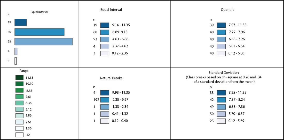
Goal: Use geographic principles to make a map of a known location or route. Notes: Basics of Cartography Goal: Have an idea of the philosophical and geographical background of cartography. Notes: Elements of Maps (TODALSIGS) Goal:Learn about the elements of a map and how they contribute to making maps that are informative, and easy to read. Activity: Using TODALSIGS Goal: Practice working with TODALSIGS to make a map that is easily readable.
| ||||||||||||||||||||
|
|
Module 4: All about MapsOpening Activity: Dealing with a Spherical Earth
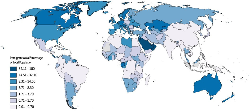
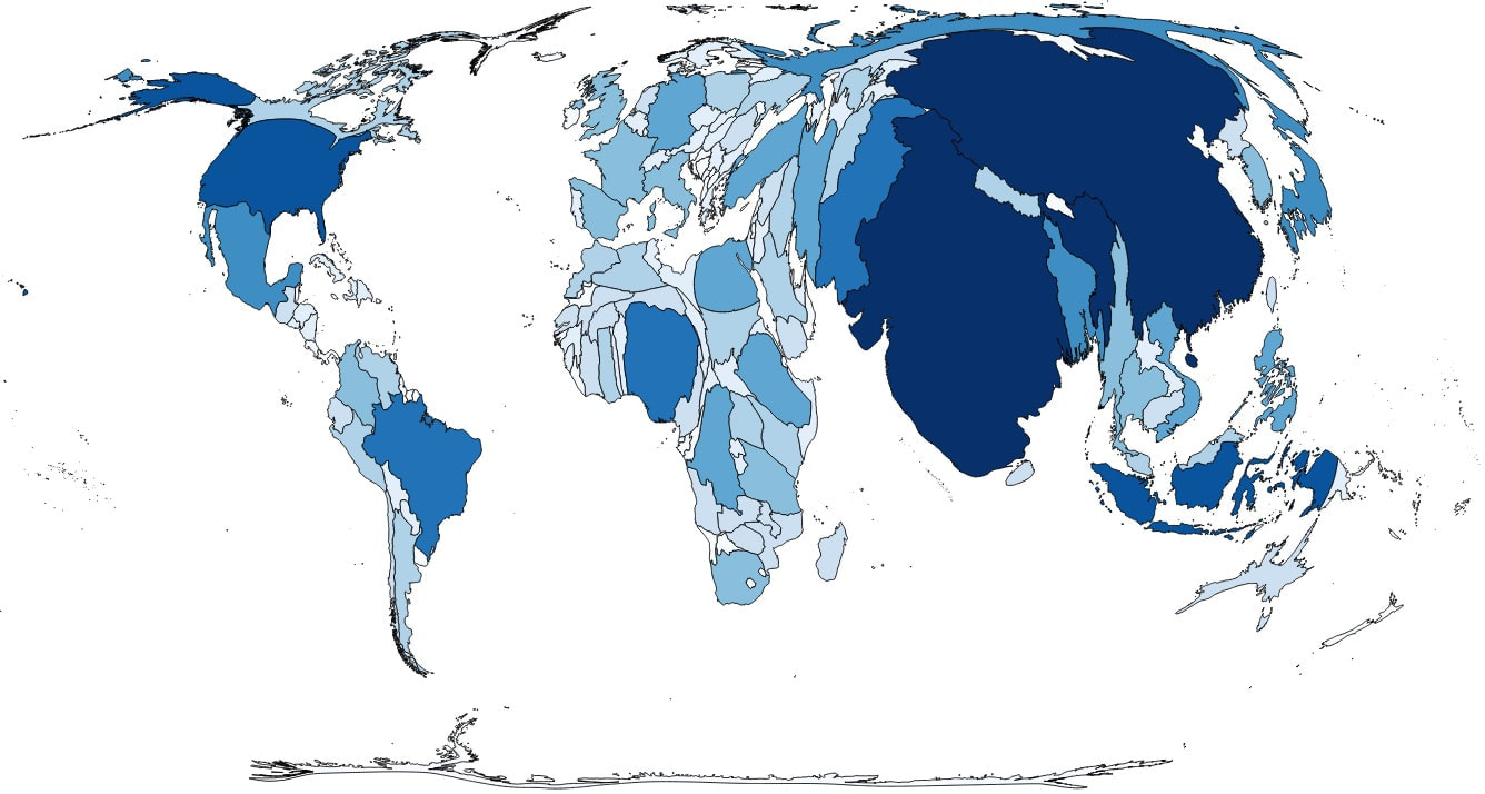
Goal: Understand the complexities of mapping locations from a spherical globe onto a flat map by trying to transfer locations from a fictitious place. Notes: Map Projections and Types of Maps Goal: Get students to understand the types of maps that can be made and the benefits of different styles and projections. Activity: Merits of Maps Goal: Judge different maps from the internet for their cartographic and geographic value.
|
Module 5: Blending CartographyOpening Activity: EarthXplorers - History of Cartography
Goal: Students will complete this online module about the ideas of cartography as a way to bring together all the elements of the previous modules. Students will also begin working with GIS to learn basic cartographic skills and make a map of their own. 
|
Module 6: Principles of GISOpening Activity: Mapping You
Goal: Students will practice making a rudimentary dot map by adding map notes in ArcGIS Online (AGO). Notes: Introduction to GIS Goal: Understand the philosophical basis for web-based mapping and the uses for it. Lecture: TED - GIS Goal: See real world applications of web maps.
| ||||||||||
Module 7: Adding Data to a WebmapOpening Activity: Simple Dot Map
Goal: Participants will get an idea of how to compile data into a .csv file and create a webmap of their own. Activity: Multi-Category Dot Map Goal:
|
Module 9: Location Join to Create a ChoroplethOpening Activity: The Population Reference Bureau
Goal: Notes: Goal: |
Module 8: Interpolation Isoline MapsOpening Activity: Analyzing 2016 Election Data
Goal: Notes: Goal: | ||||||
Cartography Resources
|


|


|
