Welcome to Mr. Tredinnick's Geographic Information Systems (GIS) Class!
"Fail Early, Fail Often, Learn By Doing" |
This one semester class explores the uses and applications of Geographic Information System (GIS) software. With the internet there is more information available than ever before, GIS gives users the possibility to display this data in new informative ways. Students will use GIS mapping software to collect, display, analyze, and share data as informational electronic maps. This project based course is part of the St. Paul Preparatory School STEM program and also counts as a social studies elective course.
| ||
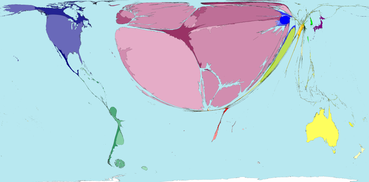
Congrats 2016 Minnesota on the Map Contest Winners!
Damla Bostan - Lake Street Mural Tour
Misia (Slowski Polski) - YMCA and McDonald's Location vs. Average Income and Age in Twin Cities
Unit I - Basics of Cartography
Unit I Course Schedule
|
Week 1: Course Introduction
(Jan 25-29) Module 1.1: Course Introduction - Mapping your Neighborhood (Assignment) - 2016 GIS Students - Snap2Map Demonstration - Introduction to GIS + Virtual Job Shadow: Climate Scientist - Go Over Syllabus HW: Download Google Earth 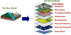
|
Week 2: The Craft of the Geographer
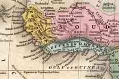
(Feb 1-5) Module 1.2: Basics of Geography - Basic Map References (Notes) - Using Latitude and Longitude...and Google Earth (Assignment) HW: Reference Point Map Quiz Module 1.3: Cartography - Reference Points Map Quiz - The History of Cartography (Notes) + Evolution of the World Map HW: Find a Map (Assignment) Module 1.4: Making Good Maps - Elements of a "Good" Map (Notes) + 1965 Vietnam, Laos, Cambodia, and Eastern Thailand Map - Examining NatGeo Maps (Assignment) + National Geographic Maps: Print Collection |
Week 3: Maps and Styles
(Feb 8-12) Module 1.5: Map Projections and Types of Maps - Exploring Map Projections (Notes) - Thematic Maps (Notes) HW: Test Next Class - Study Guide Below - Unit I Test - Basic Cartography Module 1.6: Review and Quiz - Review Time - Unit I Test - Basic Cartography + Thursday February 11th, 2016
|


Unit I Notes
Unit I Test and Quizzes Prep
|
Unit I Assignments
| ||||||||||||||||||||||
Unit I Website Links
Unit II - Principles of GIS
Unit II Course Schedule
|
Week 4: Beginning GIS
(Feb 15-19) Module 2.1: Essential Vocabulary + Basic GIS Vocabulary (Assignments) HW: You know nothing SoHo (Assignment) + Steve Johnson Ted Talk Module 2.2: Using GIS - Introduction to GIS (Notes) - Exploring ArcGIS Gallery |
|
Week 5: GIS Essentials
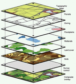
(Feb 22-26) Module 2.3: Data - Understanding GIS Data (Notes) - Pre-Planning Maps (Assignment) Module 2.4: Layers - Understanding GIS Layers (Notes) HW: Unit II Test Next Class - Study Guide Below Module 2.5: Applications of GIS - Concepts of GIS Quiz - Friday. Feb 26th HW: Applications of GIS (Assignment) |
Unit II Notes
Unit II Test Prep
|
Unit II Assignments
| ||||||||||||||||
Unit II Website Links
Unit III - Making Maps
Unit III Course Schedule
|
Week 6: Introduction to ArcGIS
(Feb 29-Mar 4) Module 3.1: Using ArcGIS - Becoming Familiar with ArcGIS (Assignment) Module 3.2: Styling a Population Choropleth - Adding and Styling Layers (Assignment) |
Week 7: Making Dot and Heat Maps
(Mar 7-11) Module 3.3: Dot Maps - Creating a Simple Dot Map (Assignment) - Creating a Multi-Category Dot Map (Assignment) HW: Finish Dot Maps Module 3.4: Developing Dot Maps Challenge 1: SPP Students (Assignment) - New Mexico Airports (Assignment) HW: Finish New Mexico Airports Map and Thought Questions Module 3.5: Open Source Data - Your Open Source Map (Assignment) - Present student's Open Source Maps - Planning a Scouting Trip (Assignment) HW: Finish the Planning a Scouting Trip Assignment |
Week 8: Layers
(Mar 14-18) Module 3.6: Create a Layer - Creating a Feature Layer (Assignment) Module 3.7: Create a Layer - Student work-time HW: Finish Creating a Feature Layer Activity 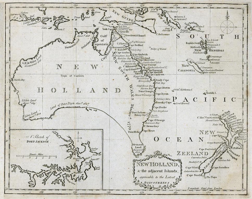
|
|
Week 9: Creating Web Apps
(Mar 21-25) Module 3.8: Swipe Map App - Creating a Swipe Map (Assignment) HW: Create your own Swipe Map + Page 3 of Creating a Swipe Map Assignment Paper Module 3.9: Examining Swipe Apps - Student Work Time - Students Present Swipe Maps HW: Environmental Swipe Maps (Assignment) + Amazon Footprint and Deforestation Module 3.10: Story Map Tour - Creating a Story Map Tour (Assignment) + Saint Petersburg City Tour |
Week 10: Creating Web Apps
(Mar 28-Apr 1) Module 3.11: GeoForm Web App - Creating a GeoForm (Assignment) HW: Have at least 20 people participate in your GeoForm Module 3.12: Unit III Wrap-Up - Make a Portfolio (Assignment) 
|
Unit III Assignments
|
| ||||||||||||||||||||||||||||||||
Unit III Website Links

|
- Spring Break -
| |||
| Snap2Map App |

Unit IV - Performing Analysis
Unit IV Course Schedule
|
Week 11: Basic Analysis
(Apr 11-15) Module 4.1: Introduction to Analysis Challenge 2: 2014 HDI Report (Assignment) + Challenge 2: 2014 HDI Report (Data Set) - HDI Predictor Map (Assignment) Module 4.2: Build a New Fire Station - Mapping Minneapolis Fire Station (Assignment) - Planning a Station Visit (Assignment) HW: Proposing a New Fire Station (Assignment) Module 4.3: Find Nearest and Trace Downstream - Finding an Airfield (Assignment) - Environmental Impact Analysis (Assignment) |
Week 12: Analysis Application
(Apr 18-22) Module 4.4: ESRI Geoinqueries - Geoinqueries (Assignment) + Borders, Boundaries, and Barriers + Whats the Range? Module 4.5: Examining Gander Mountain - Gander Mountain Distribution Center (Assignment) + Gander Mountain Store List + Gander Distribution Center |
Week 13: Market Analysis
(Apr 25-29) Module 4.6: Finish Gander Mountain - Finish Story Maps - Present Proposed Locations Module 4.7: Market Analysis - Saint Paul MLS Stadium (Assignment) Module 4.8: Data Enrichment - Finding an Apartment (Assignment) 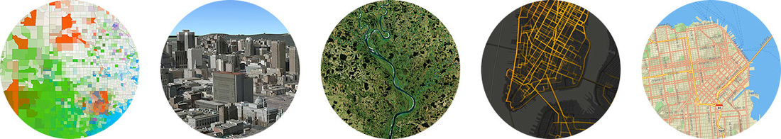
|
Unit IV Assignments
|
| ||||||||||||||||||||||||||
Unit IV Website Links
Unit V - Project Based Learning
Unit V Course Schedule
|
Week 14: Minnesota ArcGIS Map Contest
(May 2-6) Module 5.1: Minnesota ArcGIS Map Contest - Register - Minnesota on the Map (Assignment) + Work time Module 5.2: Minnesota ArcGIS Map Contest - Minnesota on the Map (Assignment) + Work time 
Week 17: Proposing a World Cup Host Site
(May 23-27) Module 5.8: World Cup Proposal - Secure the World Cup (Assignment) + Work Time Module 5.9: World Cup Proposal - Secure the World Cup (Assignment) + Work Time Module 5.10: World Cup Proposal - Secure the World Cup (Assignment) + Work Time |
Week 15: Finish ArcGIS Contest
(May 9-13) Module 5.3: Minnesota ArcGIS Map Contest - Minnesota on the Map (Assignment) + Work time Module 5.4: Minnesota ArcGIS Map Contest - Minnesota on the Map (Assignment) + Work time Module 5.5: Minnesota ArcGIS Map Contest - Minnesota on the Map (Assignment) + Work time - Share Maps 
Week 18: World Cup Presentations
(May 30 - June 3) Module 5.11 Proposed Host Side Presentations - Benelux - Australia - Kenya - Egypt - Canada - Portugal Module 5.12: Proposed Host Side Presentations - China - Colombia - Costa Rica/Panam - India - Switz/Aus/Lich - Turkey - Poland |
Week 16: Proposing a World Cup Host Site
(May 16-20) Module 5.6: World Cup Presentations - Present World Cup Proposals Module 5.7: World Cup Proposal - Secure the World Cup (Assignment) + Work Time 
Week 19: Semester Finals
(June 6-10) Module 5.13: Class Wrap-Up - Debrief World Cup Presentations - Presentation: Deb Grundmanis - Uses of GIS at the Minnesota Department of Health - End of Class Survey |
Unit V Assignments
|
| ||||
Unit V Website Links
Mr. Tredinnick's Other GIS Courses

|


|
GIS Class Forum
Click on the picture above to enter into the forum when students can discuss topics relating to the course. The forum is also a good place for students to ask questions to each other and the teacher about the course and the ArcGIS software.
| ||