Mr. Tredinnick's Class Site
  • Home
  • Geography Courses
    • AP GIS&T
    • AP Human Geography
    • Biogeography >
      • Biogeography Forum
    • Cartography
    • Ecological Biogeography >
      • Ecological Biogeography Forum
    • GEOG 1020 - Human Geography
    • GEOG 1030 - Physical Geography
    • GEOG 4100/8106 - Biogeography
    • GEOG 8040 - Seminar in Geography Education
    • Geographic Information Systems (GIS)
    • Global Studies >
      • Global Studies Forum
    • Human Geography (Rubenstein)
    • Human Geography (Tredinnick)
    • International Relations: World Environmentalism Focus >
      • International Relations: World Environmentalism Forum
    • World Geography
  • History Courses
    • AP European History >
      • AP Euro Forum
      • AP European History 2013-2014
    • AP World History
    • Art History
    • Minnesota History
    • United States History
    • World History (Fall Semester)
    • World History (Spring Semester)
    • World History Summer Session
  • Political Science Courses
    • AP Comparative Government >
      • AP Comparative Government Forum
    • AP U.S. Government >
      • AP U.S. Government Forum
    • Environmental Policy >
      • Environmental Policy Forum
    • International Relations
    • U.S. Government >
      • US Government Forum
  • Elective Courses
    • Behavioral Science >
      • Behavioral Science Forum
      • Social Science >
        • Social Science Forum
    • Economics
    • Psychology >
      • Psychology Forum
    • Sociology >
      • Sociology Forum
    • Zoo Operations: Conservation Geography
  • About

Forum 2.2 - Measuring Biomes

2/12/2019

19 Comments

 
Central Question: How can scientific data be used to track, measure, and classify biomes? 

Guiding Thought Question: What are three forms of data you would want to collect when trying to classify which biome an area was a part of? Why would those three particular data sets help you determine the biome classification?

Today's Learning Objective: Students will discuss the methods of modeling and mapping biome classifications by participating in a class discussion and completing a map geoinquiry.
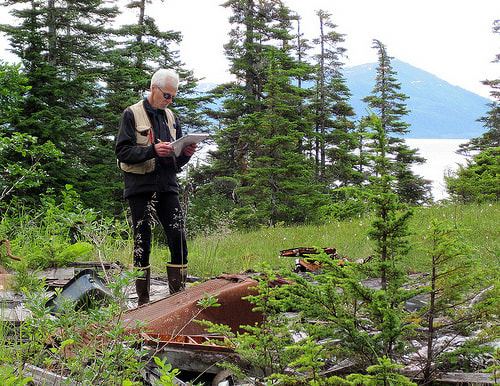
Picture
19 Comments
bob
2/9/2022 08:56:24 am

Plants, animals, and elevation. They can tell you how plentiful the resourses are and how many species are in that area

Reply
Ant
2/9/2022 08:58:04 am

Qualitative
Quantitative
Elevation
Animals

Reply
Sienna
2/9/2022 08:58:10 am

Percentage of vegetation, the tree types in an area, humidity levels. Since biomes are in the constraint of Species energy theory and are distributed based on that looking at the amount of vegetation will be a obvious marker to where you may be. The types of trees are also useful because some trees can only grow in certain conditions.Humidity also alludes to he amount of plants and how much precipitation that place gets.

Reply
emma mcgrath
2/9/2022 08:58:41 am

-typical adaptations of the animals in the area
-typical flora of the area
-soil type (rocky, normal dirt, dry/dusty, sandy, moist, etc)

identifying animals and plants are easy ways to determine where you are

Reply
Ethan
2/9/2022 08:58:53 am

Floral and Fauna, Biotic and Abiotic factors. Microbiomes that inhabit a larger biome (i.e moss) These data sets would help to determine the biome because certain species of animals and plants inhabit many different regions/biomes (black bears in the forests, polar bears in the arctic)

Reply
Emily
2/9/2022 08:58:55 am

Types of trees or if trees are present, most common animal adaptations, traits of the general landscape. This type of data collection would help determine the biome because all these traits are key indicators to specific biomes and are easily distinguishable traits.

Reply
Bea
2/9/2022 08:58:59 am

Vegetarian, wildlife, soil conditions

Reply
Peter Sukstorf
2/9/2022 08:59:50 am

You could determine the dominant species (like the species with the highest percentage of biomass), the percentage of land covered by trees, and the annual insolation. These measurements would help to determine the biome, as they are all indicators of biome. The percentage of land covered by trees indicates how much rain an area receives, the dominant species gives an indication of the temperature and biome, as certain species are usually only dominant in a single biome, and the average insolation gives an indication of temperature, as temperature is often a result of insolation.

Reply
Jack Smith
2/9/2022 09:00:10 am

Plant life - environment determines what can grow and distributions and diversity imply certain patterns regarding precipitation and temperature
GPS Positioning - knowledge about insolation and distance from poles dictates certain terrestrial and aquatic/marine habitats
Altitude - oxygen concentration and level of moisture based on height play role in biome make up, also altitude dynamics and changes within area

Reply
izzy martin
2/10/2022 12:21:50 pm

collecting plant density / what kinds of plants are there to gauge the precipitation, altitude because that’s important, and latitude to gauge what kind of area it’s in

Reply
Riley Martin
2/10/2022 12:24:43 pm

Plant life, Animal Life, and soil

Reply
Maria
2/10/2022 12:26:05 pm

Altitude, distance from equator, plant and animal species and biodiversity because they would help determine climatic conditions and what can survive in those conditions.

Reply
Braeden Irwin
2/10/2022 12:26:06 pm

Proximity to water, flora/fauna, and elevation

Reply
Braeden Irwin (continued)
2/10/2022 12:29:51 pm

You can tell a basis of wetness, what types of temperature and precipitation is happening based on those factors

Reply
Cariena
2/10/2022 12:27:29 pm

Plants
Animals
Ur Mom
Elevation

Reply
Daniel Montes
2/10/2022 12:27:39 pm

Latitude - how much Sun Energy it receives/wind
Altitude- can effect the temperature, and the precipitation
how far from large bodies of water- can also effect temp, wind currents, Precipitation

Reply
williamson
2/10/2022 12:28:37 pm

soil/sediment, animals, plant life

Reply
emma
2/10/2022 12:32:26 pm

plants, animals, and possibly soil type like if its rocky or flat and these can help figure out the biome. the plants will determine what precipitation you get in that area.

Reply
little forget link
2/10/2022 12:38:41 pm

flora and fauna, distance from the equator, and elevation.
these would help because if you don't know in which area of the world you are in you can look at the adaptions of the animals and plants of the areas,

Reply


Leave a Reply.

    Ecological Biogeography Forum

    Welcome to the Forum! Here is where you will be answering your daily warm-up questions. Please do not enter your last name for privacy reasons, and you may use a nickname if you would like (Just make sure Mr. Tredinnick is aware of the nickname you are using). Write out thoughtful responses to the forums on the days they are assigned. If you miss a day please take it upon yourself to complete the Forum you missed. Each Forum has the targeted Learning Objective(s) there so you can see what the focus of the day's class will be.

    Archives

    March 2022
    January 2022
    November 2021
    May 2021
    February 2020
    May 2019
    April 2019
    March 2019
    February 2019
    January 2019

    Categories

    All

    RSS Feed

Picture

Home

Picture

Geography for Geographers

Picture

Geopolaris Education Publications

Email: GeoKTred@gmail.com
Site Created and Maintained by Kyle Tredinnick 2010-2022